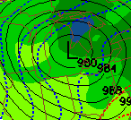
There is pretty good agreement between all of the forecast models that I trust about where this system will track.
GFS has it tracking through Saginaw:

NAM, which performed the best w/ regards to last Thursday's storm, has it tracking way north, through Alpena:

ECMWF has an extremely strong storm tracking through Alpena:

UKMET has the storm tracking right about over us:

Finally, the GGEM has the storm tracking over Saginaw:

With this kind of consistency, I am inclined to think that the forecasted track of this system won't change too much over the next 84 hours. The traditional northwest shift and less cold air have already happened, so I'm going on the assumption that the track will no longer shift any more northwest. In fact, it may shift a bit to the SE as the storm the ECMWF is forecasting is almost getting to the historically strong level if it verified. Therefore I'm going with a track similar to the GFS and GGEM, with the storm moving from NW Oklahoma around 7 pm Tuesday to Saginaw around 1 pm Wednesday.
Here is my initial forecast for the track of this storm:

So...enough with the setup of the storm, let's go over what this means for Lake Orion. Here's how I think this storm will go down:
1) As the storm approaches (12-7 am Wednesday): The 2 best things going for us about this storm is that there is going to be a good precipitation shield well ahead of the storm, and that there's going to be a good deal of cold air ahead of the storm. Therefore, as the storm approaches, a band of heavy precipitation should move into SE Michigan starting very early Wednesday Morning (just after Midnight). This precipitation should start to fall as snow. This snow will likely be fairly heavy, and accumulations will pile up quickly. All in all, I expect around 2-4" of accumulation with this initial band of snow.
2) As the storm passes over us (7 am - 4 pm Wednesday): Here's where the details get pretty ugly. The aire in front of the storm will be cold, but the low pressure system will allow a lot of warm Gulf air to move into SE Michigan. Therefore, at some point, I believe the precipitation will turn from snow to rain. In fact, enough rain could fall to melt away the initial 2-4" of snow.
3) As the storm departs (4 pm Wednesday - 11 am Thursday): As a weather lover, I can't help but get excited about this part of the storm. It won't produce huge amounts of snow, but it's going to be cool. As the storm departs, it's going to get stronger. As this happens, wind will pick up from the northwest and extremely cold air will start to move in. At some point, the rain will change back to snow. Additional snow accumulations will likely only be around an inch, maybe 2, but the wind will make things an absolute mess. When snow showers do occur, near whiteout conditions could results, as the snow will be blowing around everywhere. 30 mph winds are expected at the very least, and if winds are a little bit stronger than expected, a wind advisory could be needed. These cold, windy, and snowy conditions will continue to last through the day on Thursday.
Finally...moving on to the snow day impact. To me at least, this seems like a classic storm that gives us a small chance of a snow day. I can find a bunch of positives with this storm w/ regards to snow days. Commutes will be a mess both Wednesday and Thursday Morning. Both mornings could feature near whiteout conditions, because of heavy snow Wednesday Morning and snow showers combined with strong winds Thursday Morning. Not only that, but the strong winds could cause some power outages Wednesday Afternoon - Thursday Afternoon.
However, this is all outweighed by one overriding factor: I just don't think it will snow all that much. If we weren't going to change over to rain for 6-9 hours on Wednesday, I'd be thrilled about our snow day chances. However, the fact of the matter is, we probably will change over to rain, and that's going to limit our accumulations to something like 3-5" for the entire storm. From 3 years of experience predicting snow days, I've learned in general that if not enough snow falls, school will likely stay open, no matter how bad potential conditions may be.
So, in conclusion, I think we have to hope for a SE shift in the track of this storm for a good chance of a snow day. That's not outside the realm of possibility, but I think my forecasted track has a >60% chance of verifying. Therefore, I'll use that track to give my snow day grades for Wednesday/Thursday.
Wednesday - D = Below average chance for a snow day, but it's not impossible
Thursday - D = Below average chance for a snow day, but it's not impossible
2 comments:
damn this sucks.
So basically we are depending on the winds to help us with the snow day?
Post a Comment