Nothing really has changed with regards to the storm system that will affect us tomorrow. The National Weather Service has issued a Winter Weather Advisory tomorrow morning for the expected ice that we will get at the onset of the precipitation from this storm. We could pick up 0.1, maybe 0.2" of ice, but by late morning temperatures will rise above freezing ending the ice threat as the precipitation changes to rain. Roads will probably be a little messed up until the precipitation changes to rain, but I don't expect any major problems.
As an aside, this is another extremely notable storm system. Oklahoma City is getting an all time record for snowfall -- upwards of 12" of snow will fall there when all is said and done. As the snow shield moves north with the low pressure system, blizzard conditions will be felt all across the Plains with some areas likely reporting upwards of 24" of snow at the end of this event. This continues the string of notable storm systems this December.
Getting back to our area, the low pressure system will move north but eventually stall out in Iowa for a day before tracking northeast. This will allow several disturbances to move through the area, giving us several chances for snow showers through Monday. In the heaviest snow showers, minor accumulations are possible, but nothing significant is expected.
The only other thing worth mentioning is a storm that has a small chance of occuring around New Year's Day. The likely solution is for a weak system to move through, but there is a small chance that the storm could phase (combine with) another system moving through the Southern U.S. If this happens, a more notable storm could result. The odds are on that not happening, but with such a boring winter I figure the possibility is at least worth mentioning.
Thursday, December 24, 2009
Starting Back Up With The Once Per Day Posting
Alright so I've decided to start back up with the once per day posting unless there is absolutely nothing going on weatherwise in the next week.
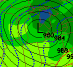
First, let's quickly go over the storm that will affect us for the next few days. Precipitation will likely start as freezing rain early Christmas Morning, because the air in the upper levels of the atmosphere is warm, but the air at ground level is below freezing. Once the ground temperature goes above freezing, precipitation will turn to rain. Before this happens, we should probably get around a tenth of an inch of ice, which will make the roads fairly slick for anyone traveling early on Christmas Morning
Christmas Day will be a rainy mess, but once the ice melts nothing bad as far as roads are concerned. One could make a case for the weather on Christmas Day being a fitting symbol for our winter so far...
Eventually, the low pressure system causing all of this weather will meander around Iowa for a day and then head northeast through Illinois, Wisconsin, and Michigan. Cold air will rush in and cause occasional snow showers during this time.
Looking at the long range, it appears we will be setting into a pattern of cold air. However, this cold air most likely will work to keep storm tracks suppressed to the south. Obviously this could change because it is the long range, but it appears that we will likely have at least a week or two more of boring weather.
Average snowfall for the Lake Orion area should be around 18" through December 31st. I would be surprised if we got 10" through December 31st. (We're currently sitting at 7.5")
Eventually, I feel that we will get a big snowstorm (8+" at once) at some point this winter. This is Michigan after all, and the storm track so far this winter has been about as unfavorable as possible for our area.
That's it for tonight's post, I'll have another post tomorrow evening.
Tuesday, December 22, 2009
Christmas Eve/Christmas Storm
At this time, nothing all that significant is expected out of the Christmas Eve/Christmas storm. We will likely see a mixture of snow sleet and freezing rain on Christmas Eve, transitioning to all rain on Christmas Day. ATTM the biggest problem will be up to a quarter inch of ice making roads slick and potentially causing a few power outages Christmas Eve.
All in all not a big storm but I'll post a slightly more detailed discussion tomorrow evening just b/c this is the first thing worth mentioning in a while.
For those who care, we are up to 7.5" of snow on the year, which unsurprisingly is running below normal.
As for the future, there are going to be more storm opportunities. This winter is an active one, with big storms; however, all of the storms are either tracking too far east or west for our benefit.
Eventually though, we should get a favorable track from one of these storms, (a) because of simple probability and chance, and (b) because El Nino should become weaker as the winter goes on, which generally gives our area a favorable storm track.
Thursday, December 17, 2009
Brief Update...Possibility of a storm around Christmas?
Hey guys, still pretty much on hiatus because nothing interesting is happening in the near term. Just though I'd give a little bit of an update. It now is starting to look like there is a possibility of a storm around the 23rd-25th of December. I have to emphasize that it is literally a guess as to where the storm will go, since the timeframe is still 6-8 days away. However, I expect the forecast models to get a better handle on this storm in the next 2-3 days. The plan right now is to have a real discussion on the potential of a storm on Sunday at noon, assuming my computer is fixed by then.
In the near term, it will stay cold for the next week, with temperatures remaining below freezing (except for tomorrow when it will get into the mid 30's). A few clipper systems will dive down from Canada during this time, and if any of these takes the right track we could get up to an inch of snow. However, there really isn't a chance of anything significant until the 23rd-25th.
In the near term, it will stay cold for the next week, with temperatures remaining below freezing (except for tomorrow when it will get into the mid 30's). A few clipper systems will dive down from Canada during this time, and if any of these takes the right track we could get up to an inch of snow. However, there really isn't a chance of anything significant until the 23rd-25th.
Monday, December 14, 2009
On Hiatus
I will be posting very little, or not at all, until Sunday, December 20th. We aren't going to see any snow totaling over 1" until around Christmas Eve at the earliest, and there's really no point in talking about that until around Saturday or Sunday.
I'll post if anything changes, but we are in a very uneventful weather pattern, and therefore there's not really any point in me posting until Sunday.
Here's hoping for some snowstorms after winter break.
I'll post if anything changes, but we are in a very uneventful weather pattern, and therefore there's not really any point in me posting until Sunday.
Here's hoping for some snowstorms after winter break.
Thursday, December 10, 2009
And sure enough...
we don't have a snow day. Lots of hype b/c of icy roads, but icy roads happen all the time over the course of a Michigan winter. This was just the first time. The facts, a forecasted 2-4" of snow, did not support a snow day and sure enough, we didn't get one.
Anyways, about 2" more to boost our season total to 4.5". By the time the occasional snow showers end tonight, we probably will pick up another inch.
Anyways, about 2" more to boost our season total to 4.5". By the time the occasional snow showers end tonight, we probably will pick up another inch.
Wednesday, December 9, 2009
Update...***Still think we will not have a snow day***
Roads are apparently becoming icy now that some heavy snow/sleet is falling. I think that they will be okay for tomorrow morning, however, this obviously adds to my equation in my below post, therefore raising the chances of a snow day.
I still don't think we'll have one, though.
***Update #2***
Winter weather advisory issued until 10 am for 2-4" of snow...definitely another thing helping our chances. Could it happen??? I still don't think so, because I've gotten burned by events just like this in the past, but it has become somewhat more likely since I made my first post.
School tomorrow? First nonzero snow day chance...
I'm going to break down our snow day chances into three parts:
Wind/Whiteout Conditions: As some people may have already guessed by now, the forecast of 50-60 mph wind gusts with this storm was a bust. Wind gusts topped out at about 45 mph late this afternoon. Sure, that's strong, but it's nothing too out of the ordinary when it comes to Michigan weather. Wind gusts between 30-45 mph should continue through late afternoon tomorrow. Still, though, when combined with heavy snow, those winds should cause near-whiteout conditions. We will get occasional heavy snow overnight, but I wouldn't rely on it for a snow day. The near-whiteout conditions just aren't going to happen frequently enough.
Updated Snow Map (8 pm tonight - 5 pm tomorrow)

Icing On Roads: Nonfactor. Drove on some dirt roads...there is almost no icing. As is usually the case when temperatures quickly drop below freezing, the wind caused the rain to evaporate before it could freeze on the roadways.
Power Outage: This is really what any hope of a snow day hinges on. According to DTE's twitter page, there are about 40,000 outages right now because of this storm. I'd assume that number will go up to between 75,000 and 100,000 by the end of this storm. The wind isn't extrordinarily bad, but it's enough to knock out more power, especially when combined with the occasionally heavy snow and sleet we're going to get overnight. So...there is some chance of a power outage, but not enough to make me think we have a good chance of a snow day.
So...in conclusion:
Wind/Whiteout Conditions: Will happen, but not frequently enough.
Icing On Roads: Nonfactor
Power Outages: There will be some, but they won't be widespread.
Therefore, I unfortunately have to make the prediction that we will have school tomorrow.
2.5" of snow
Of course it's melting now...but we're "on the board" for winter 2009-10 as far as accumulating snow goes.
Tuesday, December 8, 2009
No snow day tomorrow, but what about Thursday?
The precipitation shield from the large storm system is currently on our doorstep, as a look at the current radar confirms:

Precipitation should begin falling within the hour, and it should fall as snow, at least at the start. After a few hours though, the warm air that is moving into the area will cause the precipitation to change over to rain. Before then, though, the snow that falls could be rather heavy, and therefore I am sticking with my forecast for 1-3" of snow for Lake Orion. We should have no trouble getting at least an inch out of this initial band, and I tend to feel that if we get just 3-4 hours of snow before the changeover occurs, we'll get at least 2 inches. However, once the rain starts falling, I expect the snow to melt away just as quickly as it accumulates, with the end result of very little snow on the ground when we wake up tomorrow.
All in all, I continue to like my snow map from last night:
 .
.
Tomorrow evening through Thursday morning is when things get interesting. First of all, the low pressure system is going to rapidly strengthen as it passes to our northwest (in fact it's going to be one of the strongest winter storms to affect the Midwest in the last 5 years). This is going to result in very strong winds. In fact, a high wind watch has been posted. I expect us to get 35 mph sustained winds with 55 mph wind gusts from early afternoon Wednesday to early morning Thursday. Winds will continue to gust above 40 mph through Thursday afternoon.
Compounding the problem of high winds is the expectation of a decent lake effect snow event tomorrow night and during the day on Thursday behind the low pressure system. Winds will be out of the west, and very strong, which means that we are set up pretty good for lake effect snow. The problem with lake effect snow is that just a 5 degree difference in wind direction means a large difference in where the main band of snow sets up. As of right now, I expect the main band to set up in the vicinity of the M-59 corridor.
These two simulated radar images for 11 pm tomorrow night and 2 am Thursday morning pretty much represent where I think the main band of snow will be.


Based on these expectations, here's my snow forecast from 5 p.m. tomorrow night to 1 p.m. Thursday afternoon.

An important thing to note from the above map is that just a few miles could make a large difference in your snow totals; therefore, this forecast is subject to change. However, if we actually get 2-4" of snow falling, that would prove to be problematic. Combined with the 40-50 mph winds, it would cause near whiteout conditions. Combined that with the possibility of power outages, and the possibility of rain freezing over on the dirt roads, and you begin to get several things that *could* cause a snow day on Thursday.
Therefore, I'll raise the snow day grade for Thursday to a "C". I'm still leaning towards us not getting a snow day on Thursday, and I will probably predict that tomorrow night, but there's definitely a chance.

Precipitation should begin falling within the hour, and it should fall as snow, at least at the start. After a few hours though, the warm air that is moving into the area will cause the precipitation to change over to rain. Before then, though, the snow that falls could be rather heavy, and therefore I am sticking with my forecast for 1-3" of snow for Lake Orion. We should have no trouble getting at least an inch out of this initial band, and I tend to feel that if we get just 3-4 hours of snow before the changeover occurs, we'll get at least 2 inches. However, once the rain starts falling, I expect the snow to melt away just as quickly as it accumulates, with the end result of very little snow on the ground when we wake up tomorrow.
All in all, I continue to like my snow map from last night:
 .
.Tomorrow evening through Thursday morning is when things get interesting. First of all, the low pressure system is going to rapidly strengthen as it passes to our northwest (in fact it's going to be one of the strongest winter storms to affect the Midwest in the last 5 years). This is going to result in very strong winds. In fact, a high wind watch has been posted. I expect us to get 35 mph sustained winds with 55 mph wind gusts from early afternoon Wednesday to early morning Thursday. Winds will continue to gust above 40 mph through Thursday afternoon.
Compounding the problem of high winds is the expectation of a decent lake effect snow event tomorrow night and during the day on Thursday behind the low pressure system. Winds will be out of the west, and very strong, which means that we are set up pretty good for lake effect snow. The problem with lake effect snow is that just a 5 degree difference in wind direction means a large difference in where the main band of snow sets up. As of right now, I expect the main band to set up in the vicinity of the M-59 corridor.
These two simulated radar images for 11 pm tomorrow night and 2 am Thursday morning pretty much represent where I think the main band of snow will be.


Based on these expectations, here's my snow forecast from 5 p.m. tomorrow night to 1 p.m. Thursday afternoon.

An important thing to note from the above map is that just a few miles could make a large difference in your snow totals; therefore, this forecast is subject to change. However, if we actually get 2-4" of snow falling, that would prove to be problematic. Combined with the 40-50 mph winds, it would cause near whiteout conditions. Combined that with the possibility of power outages, and the possibility of rain freezing over on the dirt roads, and you begin to get several things that *could* cause a snow day on Thursday.
Therefore, I'll raise the snow day grade for Thursday to a "C". I'm still leaning towards us not getting a snow day on Thursday, and I will probably predict that tomorrow night, but there's definitely a chance.
Monday, December 7, 2009
Tinkering With My Forecast & First Snowfall Map
Since my post yesterday morning, the forecast models have stayed remarkably consistent with this storm. Therefore, I will make only minor changes with my storm track. I'll adjust the track only the slightest bit northward, going from Oklahoma to St. Louis to just south of Chicago and into the Saginaw Bay.

However, despite the consistent track, it will not be until the last minute that anyone will be certain about the effects of this storm, due to the fact that we will be so close to the rain/snow line. I do know for sure that we will receive rain from this storm for an extended period of time. What I do not know is exactly when the snow will change over to rain tomorrow night, which will have adverse effects on our accumulation totals with the first band of snow tomorrow night. Right now, I believe that the snow will start a little earlier than previously expected, around 9:00 p.m. I believe we will have a good 3-5 hours of snowfall before the precipitation changes over to rain. This is a little less time than previously expected; therefore, I will put accumulations down to 1-3" inches. The National Weather Service currently has us forecast for only 1" of snow tomorrow night; however, I feel we'll see light/moderate snow for at least 3 hours, which I believe is enough time to pick up more than an inch of snow. Therefore, the high end of my accumulation is more than their accumulation forecast.
To our south, the snow will change over to rain rather quickly, therefore, locations to the south will receive less snow. To our north, precipitation will stay as snow longer; in fact, the Tri-Cities area could stay as all snow for the entire storm. Therefore, locations to our north will receive more snow.
Here's my snow map for the time period 8:00 p.m. Tuesday - 8:00 a.m. Wednesday. Please note that north and west of Saginaw could see some more snow during the day on Wednesday, and everyone will see more snow Wednesday Night. I'll have my snow map for the entire storm out tomorrow night.

Beyond the minor change up in the initial band of snow, I still expect the rest of the storm to play out the same as what I said yesterday morning. So, if you're looking for the forecast for Wednesday, scroll down to the last post.
Snow Day Chances:
Wednesday: I'd put this at an "E" except for the fact that there is a small possibility for ice early Wednesday Morning. If ice occurs, it would be because a high pressure system to our northeast could produce easterly winds bringing in cold air. If this happens, it is conceivable that the warm Gulf of Mexico air that the strong low pressure is bringing up could "overrun" the cold air and the rain could freeze as it hits the ground, producing (obviously) freezing rain. However, this is a small possibility in the first place and even if ice occurred, its effects would likely be mitigated by the snow already on the ground. Still, I'll just leave the grade at a "D" for Wednesday just to be safe. It's a low "D" though.
Thursday: This is a better chance than Wednesday. 40-50 mph winds will move cold air in really quickly, potentially causing a "flash freeze" as temperatures drop 5-10 degrees per hour, quickly freezing over the rain that will have fallen on Wednesday. Not only that, but the 40-50 mph winds will also give us a good setup for lake effect snow. When snow does occur, near whiteout conditions will result, due to the 40-50 mph winds. Lastly, the winds could cause some power outages. However, I've gotten burned predicting snow days before with conditions like these, and therefore I'm extremely hesitant to move the snow day grade above a "D". It's a high "D" though.
Sunday, December 6, 2009
Large Storm To Impact Area Tuesday Night/Wednesday
An anomalously strong storm system will have adverse effects to our area Tuesday Night - Wednesday. I first mentioned this storm in a post two days ago, stating that we were projected to be in a pretty good spot with this system, but also asking "when is the last time you've heard of a forecast staying exactly the same through five days?" That's why I really try not to hype anything up until it's 3 days or less away from impact, and that once again rings true with this storm system. It still has a good shot at producing some moderate snow accumulations for our area, but the best accumulations will likely occur to our northwest.
There is pretty good agreement between all of the forecast models that I trust about where this system will track.
GFS has it tracking through Saginaw:
NAM, which performed the best w/ regards to last Thursday's storm, has it tracking way north, through Alpena:

ECMWF has an extremely strong storm tracking through Alpena:

UKMET has the storm tracking right about over us:

Finally, the GGEM has the storm tracking over Saginaw:

With this kind of consistency, I am inclined to think that the forecasted track of this system won't change too much over the next 84 hours. The traditional northwest shift and less cold air have already happened, so I'm going on the assumption that the track will no longer shift any more northwest. In fact, it may shift a bit to the SE as the storm the ECMWF is forecasting is almost getting to the historically strong level if it verified. Therefore I'm going with a track similar to the GFS and GGEM, with the storm moving from NW Oklahoma around 7 pm Tuesday to Saginaw around 1 pm Wednesday.
Here is my initial forecast for the track of this storm:

So...enough with the setup of the storm, let's go over what this means for Lake Orion. Here's how I think this storm will go down:
1) As the storm approaches (12-7 am Wednesday): The 2 best things going for us about this storm is that there is going to be a good precipitation shield well ahead of the storm, and that there's going to be a good deal of cold air ahead of the storm. Therefore, as the storm approaches, a band of heavy precipitation should move into SE Michigan starting very early Wednesday Morning (just after Midnight). This precipitation should start to fall as snow. This snow will likely be fairly heavy, and accumulations will pile up quickly. All in all, I expect around 2-4" of accumulation with this initial band of snow.
2) As the storm passes over us (7 am - 4 pm Wednesday): Here's where the details get pretty ugly. The aire in front of the storm will be cold, but the low pressure system will allow a lot of warm Gulf air to move into SE Michigan. Therefore, at some point, I believe the precipitation will turn from snow to rain. In fact, enough rain could fall to melt away the initial 2-4" of snow.
3) As the storm departs (4 pm Wednesday - 11 am Thursday): As a weather lover, I can't help but get excited about this part of the storm. It won't produce huge amounts of snow, but it's going to be cool. As the storm departs, it's going to get stronger. As this happens, wind will pick up from the northwest and extremely cold air will start to move in. At some point, the rain will change back to snow. Additional snow accumulations will likely only be around an inch, maybe 2, but the wind will make things an absolute mess. When snow showers do occur, near whiteout conditions could results, as the snow will be blowing around everywhere. 30 mph winds are expected at the very least, and if winds are a little bit stronger than expected, a wind advisory could be needed. These cold, windy, and snowy conditions will continue to last through the day on Thursday.
Finally...moving on to the snow day impact. To me at least, this seems like a classic storm that gives us a small chance of a snow day. I can find a bunch of positives with this storm w/ regards to snow days. Commutes will be a mess both Wednesday and Thursday Morning. Both mornings could feature near whiteout conditions, because of heavy snow Wednesday Morning and snow showers combined with strong winds Thursday Morning. Not only that, but the strong winds could cause some power outages Wednesday Afternoon - Thursday Afternoon.
However, this is all outweighed by one overriding factor: I just don't think it will snow all that much. If we weren't going to change over to rain for 6-9 hours on Wednesday, I'd be thrilled about our snow day chances. However, the fact of the matter is, we probably will change over to rain, and that's going to limit our accumulations to something like 3-5" for the entire storm. From 3 years of experience predicting snow days, I've learned in general that if not enough snow falls, school will likely stay open, no matter how bad potential conditions may be.
So, in conclusion, I think we have to hope for a SE shift in the track of this storm for a good chance of a snow day. That's not outside the realm of possibility, but I think my forecasted track has a >60% chance of verifying. Therefore, I'll use that track to give my snow day grades for Wednesday/Thursday.
Wednesday - D = Below average chance for a snow day, but it's not impossible
Thursday - D = Below average chance for a snow day, but it's not impossible
There is pretty good agreement between all of the forecast models that I trust about where this system will track.
GFS has it tracking through Saginaw:

NAM, which performed the best w/ regards to last Thursday's storm, has it tracking way north, through Alpena:

ECMWF has an extremely strong storm tracking through Alpena:

UKMET has the storm tracking right about over us:

Finally, the GGEM has the storm tracking over Saginaw:

With this kind of consistency, I am inclined to think that the forecasted track of this system won't change too much over the next 84 hours. The traditional northwest shift and less cold air have already happened, so I'm going on the assumption that the track will no longer shift any more northwest. In fact, it may shift a bit to the SE as the storm the ECMWF is forecasting is almost getting to the historically strong level if it verified. Therefore I'm going with a track similar to the GFS and GGEM, with the storm moving from NW Oklahoma around 7 pm Tuesday to Saginaw around 1 pm Wednesday.
Here is my initial forecast for the track of this storm:

So...enough with the setup of the storm, let's go over what this means for Lake Orion. Here's how I think this storm will go down:
1) As the storm approaches (12-7 am Wednesday): The 2 best things going for us about this storm is that there is going to be a good precipitation shield well ahead of the storm, and that there's going to be a good deal of cold air ahead of the storm. Therefore, as the storm approaches, a band of heavy precipitation should move into SE Michigan starting very early Wednesday Morning (just after Midnight). This precipitation should start to fall as snow. This snow will likely be fairly heavy, and accumulations will pile up quickly. All in all, I expect around 2-4" of accumulation with this initial band of snow.
2) As the storm passes over us (7 am - 4 pm Wednesday): Here's where the details get pretty ugly. The aire in front of the storm will be cold, but the low pressure system will allow a lot of warm Gulf air to move into SE Michigan. Therefore, at some point, I believe the precipitation will turn from snow to rain. In fact, enough rain could fall to melt away the initial 2-4" of snow.
3) As the storm departs (4 pm Wednesday - 11 am Thursday): As a weather lover, I can't help but get excited about this part of the storm. It won't produce huge amounts of snow, but it's going to be cool. As the storm departs, it's going to get stronger. As this happens, wind will pick up from the northwest and extremely cold air will start to move in. At some point, the rain will change back to snow. Additional snow accumulations will likely only be around an inch, maybe 2, but the wind will make things an absolute mess. When snow showers do occur, near whiteout conditions could results, as the snow will be blowing around everywhere. 30 mph winds are expected at the very least, and if winds are a little bit stronger than expected, a wind advisory could be needed. These cold, windy, and snowy conditions will continue to last through the day on Thursday.
Finally...moving on to the snow day impact. To me at least, this seems like a classic storm that gives us a small chance of a snow day. I can find a bunch of positives with this storm w/ regards to snow days. Commutes will be a mess both Wednesday and Thursday Morning. Both mornings could feature near whiteout conditions, because of heavy snow Wednesday Morning and snow showers combined with strong winds Thursday Morning. Not only that, but the strong winds could cause some power outages Wednesday Afternoon - Thursday Afternoon.
However, this is all outweighed by one overriding factor: I just don't think it will snow all that much. If we weren't going to change over to rain for 6-9 hours on Wednesday, I'd be thrilled about our snow day chances. However, the fact of the matter is, we probably will change over to rain, and that's going to limit our accumulations to something like 3-5" for the entire storm. From 3 years of experience predicting snow days, I've learned in general that if not enough snow falls, school will likely stay open, no matter how bad potential conditions may be.
So, in conclusion, I think we have to hope for a SE shift in the track of this storm for a good chance of a snow day. That's not outside the realm of possibility, but I think my forecasted track has a >60% chance of verifying. Therefore, I'll use that track to give my snow day grades for Wednesday/Thursday.
Wednesday - D = Below average chance for a snow day, but it's not impossible
Thursday - D = Below average chance for a snow day, but it's not impossible
Saturday, December 5, 2009
No New Post Tonight
New post will for sure be up by noon tomorrow...just don't feel like writing this when I'm tired it wouldn't be very good.
Friday, December 4, 2009
Quick Post...in between events
Well nothing interesting is happening w/ regards to snow right now, and nothing interesting will happen until Wednesday, so just a quick post tonight.
Monday a weak system is still expected to move through. We'll get some snow out of the system, anywhere from 1-2" looks to be a decent bet.
The possible big storm will occur on Wednesday. A strong low pressure system will eject out of the Rockies, zipping quickly off to the ENE. I'm going to be perfectly honest that right now, the models have SE Michigan in a pretty good spot with this system. That's great, but when is the last time you've heard of a forecast staying exactly the same through five days? I'm at least partially excited about this upcoming storm, but I'm going to hold off on hyping it at all for a day or two. For now I'll just put it out there that there is a chance of significant snowfall on Wednesday, if everything works out correctly.
Check back here tomorrow night for a longer post featuring more details of the Wednesday system, as I will be able to state where it will track with a greater certainty, allowing me to discuss realistic snowfall possibilites for our area based on what I feel the track will be.
For now, I'll set the snow day grade for the Wednesday system to a C, simply because we're the frontrunners for receiving a potentially significant snowstorm in 5 days. Specific details obviously can/will change, and as they do, I'll adjust the grade up/down accordingly as we get closer to the event.
Thursday, December 3, 2009
First Real Snow of the Season...Yes it's actually gonna happen this time
Yes, we are actually going to get our first real snow of the season tonight. As I said yesterday, this is a nearly perfect setup for lake effect snow for our area (still doesn't mean we're going to get much) and with an upper low moving through the area to help things out, there is an extremely high chance of lake effect snow showers moving through our area overnight.
Let's take a look at the current radar:
Let's take a look at the current radar:

The band stretching roughly along and south of the I-96 has been propogating eastward in from Lake Michigan over the last few hours. This trend is expected to continue overnight, with the band moving through our area around midnight. Snowfall could actually be rather heavy at times with this band, but it will not be a long duration event, so I expect accumulations to be limited to around an inch.
Snow will also fall occasionally tomorrow. It will continue to be rather heavy at times when it does fall, and in the heaviest showers, some minor accumulations could occur.
Looking ahead to the longer range, a weak storm system could move through on Monday with some more minor accumulations. In addition, a stronger storm could move through in the middle of next week, but the models are all over the place with where it's supposed to track, so I'll hold off on talking about that one in detail. Most likely someone will get their first winter storm of the season, but it's anyone's guess who that will be at this point.
Wednesday, December 2, 2009
Nothing good coming out of this storm...but after?
There is no need to cover the ongoing storm for more than a paragraph, as I already called it a "bust" yesterday and explained why it was a bust, so if that's what you're looking for, scroll down to yesterday's post. Sadly enough, the rain that is currently occurring is the storm that was previously forecast to give us a couple of inches of snow. Obviously...that isn't happening as the cold air just isn't going to come in fast enough to give us anything more than a half inch of snow by the time it departs.
Fortunately for people who have been eagerly anticipating a coating of snow on the ground, a better possibility awaits after this storm exits the area. In its wake, cold air will arrive in earnest, with temperatures falling below freezing tomorrow night. This, combined with a strong westerly flow, will serve to allow for the formation of lake effect snow off of Lake Michigan. For those who don't know, our location isn't in a good spot to receive much lake effect snow, but tomorrow night is a setup we can work with. Snow showers will become likely during the early morning hours on Friday with accumulations of up to an inch possible.
The snow day grade with any of the above mentioned events remains at an E.
Tuesday, December 1, 2009
First "Bust" of the Season and Lessons Learned
Only one subject to cover tonight, and that is the Wednesday Night/Thursday Morning storm, which is rapidly becoming an early disappointment. While the forecast models, if anything, have shifted a bit to the east from yesterday, two other overriding factors lead me to tone down the accumulation forecast. The first factor is that the cold air just isn't going to come in quickly enough for any significant snow to fall. Obviously, it's early in the meteorological winter so cold air will usually be a problem, but I admit that I never expected it to be this much of a problem. The other factor is that surface observations support the low to track a bit further to the west of where it is being forecasted by the models. This as well does not help snow accumulations. Therefore, I am toning down forecasted accumulations with this storm to around 1".
Obviously, this is disappointing, but the weather is inherently unpredictable and it's a given that most forecasts will have to be adjusted as we get closer to the event. If one looks back through earlier blog entries, one will find many other times when my original accumulation forecast had to be adjusted up or down as the event drew closer (although somehow...only the downward adjustments seem to get noticed :P).
Still, there are lessons to be learned from every busted forecast, and here are the ones I offer up:
1) Expect the westward shift to be present again this winter. A theme of the last few winters has been forecast models ejecting an upper low out of the southwest too quickly, resulting in an original storm track of further east than what actually happens. Based on this storm, that trend may be occurring again this winter and I will have to watch out for that and take that into account when forecasting 3-7 days out.
2) Forecast models usually overdo cold air, especially early in the season. Somehow, cold air always ends up being one of the main problems for almost all winter storms, especially early in the season. Yet forecast models usually don't see this problem until 2-3 days before the storm. After a long break from forecasting, I admittedly underestimated the cold air problem and hope to better account for the cold air problem in future forecasts.
So although this storm won't have much to offer up in the way of snow, it offers me a chance to learn from my mistakes and improve my forecasting as the season goes on. And I would still look for snow to be falling Thursday morning, just not as much as previously expected.
Finally, I would like to close by offering up a new "grading system" of snow day probabilities for Lake Orion. I will still be doing yes/no predictions the night before any significant storm, but for the medium/long range I will offer a quick look at the possibilities of a snow day with a grading scale.
This idea was proposed to me by Vinnie Warren, and I thank him for suggesting it, as it is a good idea.
A = Lock it in, snow day has a great shot at happening
B = Above average chance for a snow day, but there's still things that could go wrong
C = Average chance for a snow day, things could break either way as the storm draws closer
D = Below average chance for a snow day, but it's not impossible
E = Forget about it, move on to the next storm if you only read this for snow day chances
For the Thursday Morning Storm, the current snow day grade is an E.
Monday, November 30, 2009
50/50 chance of waking up to snow tomorrow morning...better chance Thursday morning
The snow forecast starts with the weak system moving down from Canada tonight. Temperatures are marginal for snowfall, so the precipitation may start off as rain, but will change over to snow at some point. The other question is if the precipitation will extend far enough to the south for us to get any. Looking at the current radar...

The precipitation is currently around where anticipated by the forecast models, if not a bit south. These models show the southern portion of the precipitation brushing us late tonight, so I'd say there's about a 50/50 chance of us waking up to some snow tomorrow morning. Admittedly this doesn't look as good as it did last night, but it wasn't going to be that much in the first place, so I wouldn't worry too much...
Looking ahead to the potentially bigger storm on Wednesday Night/Thursday Morning, the overall model trend has been to shift the storm slightly to the west. However, the most reliable forecast model, the ECMWF, keeps the storm in about the same place as it was forecasted to be yesterday. The ECMWF is entering its so called "deadly" range where it locks on to the track of a storm and the track of the storm ends up being very similar to what is forecasted. Therefore, I tend to favor the usage of that model when forecasting what will happen with this storm. Of course, there is some uncertainty as always when forecasting 3 days out and the ECWMF still has a shot at tracking the storm further west during its next two runs. However, I feel it is more likely that the other models adjusted the low too far to the west, and will end up adjusting back to the more easterly track of the ECMWF.
Here's an image of where the ECMWF forecasts the storm to be Thursday Morning:

Squinting, one can see that the low pressure is forecast to be around Buffalo Thursday Morning. Compared with yesterday's position, the track of the ECMWF hasn't changed much at all, and I will therefore stick to my forecast of rain Wednesday Night changing over to snow shortly after midnight before ending shortly after 12 pm on Thursday. As for accumulation amounts, I would expect 2-3" of heavy, wet snow. The main accumulation will be on cold/grassy surfaces, and even on those surfaces the snow won't accumulate right away because of ground temperatures still being above freezing (the delayed accumulation usually happens because of this with every first snowfall). On roadways, I would be surprised to see much more than just slush accumulating. So obviously there will be no snow day with this storm, but it should still offer up the first accumulating snow of the season and make driving a mess Thursday Morning.
Sunday, November 29, 2009
Snow Monday Night, then something bigger brewing later in the week?
It is finally time to pay attention to the possibility of accumulating snow in Lake Orion, as we will likely get a quick inch of snow tomorrow night, and a decent shot at getting our first notable accumulation of the 2009-10 snow season with a storm system later in the week.
First, I'd like to give a quick mention to a system tomorrow night that will move through and more than likely give us our first measurable snowfall of the year. It's not going to be anything too big - just a quick half inch or inch of snow ending by sunrise Tuesday morning - but it's still worth mentioning as it will be the first measurable snow of the season.
More notable is going to be a system that will affect us late Wednesday Night and through the day on Thursday. There is fairly good consistency among the different forecast models w/ regards to the track of this system, considering that it is still 4 days away.
Take a look at the forecasted position of this system Thursday Morning from 4 different forecast models (from top to bottom, the GFS, ECMWF, GGEM, and UKMET). They all support a track along or just west of the spine of the Appalachian Mountains. Personally, I prefer a track just west of the spine as I think it would be unreasonable to expect the northern stream trough to phase (combine with) the upper level low in the Southern U.S. so late that the track would be up the spine of the Appalachians. (More on this subject two paragraphs down)


Considering a track just west of the spine of the Appalachians, I would say it is fairly reasonable to expect that we will get some accumulating snow on Thursday. The projected track is a pretty good winter storm track for our area, but the cold air does not look to be in place until after the precipitation starts. Therefore I would say it's reasonable to expect precipitation starting as a cold rain on Wednesday Night before turning over to snow Thursday Morning and dropping a small to moderate amount of accumulation before departing the area Thursday Afternoon.
This is a fairly advanced subject that is more than what is usually covered on the evening news, but I figure it's in my best interest to point it out anyways, so I will say that one thing to note that could potentially change the track is that there is a "northern stream" trough that will phase (combine with) an upper low pressure system across the Southern U.S., giving us our storm system. Currently, this is not expected to happen until Wednesday Night. However, if this phasing happened earlier, it would also happen further west, and the storm system would thusly track further west, which would likely give us more rain, with a later changeover to snow, and therefore less snow accumulation. If it does appear that the systems will phase together earlier, I will mention it in a future post and adjust my forecast as such.
However, the bottom line is that I currently expect a few inches of accumulation with this system. It doesn't have a very good shot at giving us a snow day, but it has a decent shot at being our first notable accumulation of the season.
Sunday, April 5, 2009
Final Forecast
5-9" of snow for Lake Orion is my final prediction.
We would definitely get a snow day if this wasn't Spring Break.
We would definitely get a snow day if this wasn't Spring Break.
Saturday, April 4, 2009
National Championship Snowstorm
Based on the latest forecast model runs, 4-8" of snow could easily fall on Monday.
Not going to post much more on this because in all honesty, I'm going to be in Pennsylvania on Monday, this has no chance of giving us any snow days b/c it's over Spring Break, I haven't forecasted a snow event in well over a month, and in general, I'm just sick of snow.
But just know that there will likely be a late-season snowstorm on Sunday Night - Monday. Might do a snow map before I leave for PA tomorrow morning.
In all honesty, we shoudl have seen this coming. When is there not a snowstorm when Detroit hosts a major sporting event?
Wednesday, April 1, 2009
What? More snow?
Don't look now, but there could be a nice little snowstorm setting up for the Monday timeframe (of course it has to occur over Spring Break!). Winter may not be over yet (while technically it is still Spring of course).
Saturday, February 21, 2009
Well this one was yet another downer
Blame the low going north of what was forecasted and blame the dry air for causing what was supposed to be an awesome first band to dissipate, but the bottom line is that this storm will be yet another bust, with Lake Orion probably picking up 3-4" when all is said and done.
Someone will get 6-10" from this...unforunately, that someone is northern Michigan.
P.S. - I'm just about done with winter if all we're going to get is busts.
Someone will get 6-10" from this...unforunately, that someone is northern Michigan.
P.S. - I'm just about done with winter if all we're going to get is busts.
Friday, February 20, 2009
Final Snow Map

The forecast models have trended the low pressure track even further north since yesterday, meaning less snow for us as snow ratios become lower (12:1 or so) and we get hit by a big time dry slot. Still expecting 5-7" of snow over 6 hours or so tomorrow. Not expecting a snow day ATTM though.
Thursday, February 19, 2009
Enhanced Alberta Clipper will dump snow on Southeast Michigan this weekend.
A low pressure system will drop out of Alberta tomorrow, then dive down to around St. Louis by tomorrow night. From there I expect this low pressure system to track approximately from St. Louis to Normal, Illinois to Toledo, Ohio and then off to the northeast into Canada. This low pressure system will likely produce a nice snowstorm for Southeast Michigan this weekend.
Now, Alberta Clippers usually give us only "nuisiance snowfalls" of around 3-6". Earlier this week, that was what this clipper was supposed to do, as it was originally forecasted to track well to our south (from Lincoln, Illinois to Indianapolis to Columbus). However, forecast models have moved the track to the north in the last day or so, and are now in strong agreement on a track similar to the one I mentioned in the first paragraph. This track will allow Southeast Michigan to get in on the main snow shield, and therefore get the highest accumulations out of this system. And since this is a stronger than normal Alberta Clipper, snow totals will be higher than the normal 3-6" expected from Alberta Clippers.
How high will snow totals be? Here's my snowfall map:

My accumulations are on the high end of the forecasts of professional meteorologists, and here's why:
First of all, some definitions will be necessary...
The GFS and the NAM are the two forecast models which I use to figure out approximately how much precipitation we will receive from a particular system.
QPF is an acronym for "Quantitative Precipitation Forecast". It's basically a fancy way of saying how much liquid precipitation will fall in a particular area based on forecast model guidance.
Finally, snow ratios are how many inches of snow you could receive from one inch of rain. For example, a 10:1 snow ratio (a normal snow ratio at 32 degrees) means that for every inch of rain that falls, you would get 10 inches of snow. Since we will have temperatures in the mid 20's on Saturday, we will get higher snow ratios (around 15:1 to 18:1). Multiply the QPF and the expected snow ratios to get the expected snowfall.
So, here goes nothing:
A blend of GFS and NAM QPF totals generally supports 0.30-0.55” of QPF falling in SE Michigan with this system, with the higher QPF over the southern portion of the forecast area, closer to the low pressure system. Assume 0.45-0.55” of QPF over the southern half of the forecast area, with snow ratios between 15:1 and 18:1. 0.45*15 = 6” of snow (lower limit) and 0.55*18 = 9.9” of snow (upper limit). Therefore, I have forecasted a general 6-10” of accumulation over the southern half of the forecast area. Then, assume 0.30-0.45” of QPF over the northern half of the forecast area, with snow ratios between 18:1 and 20:1. 0.30*18 = 5.4” of snow, and 0.45*20 = 9” of snow. However, I have bumped down accumulations about an inch for the northern half of the forecast area because clippers tend to have fairly sharp accumulation cutoffs.
I have also included a "locally 12 inches" mention over the southern half of the forecast area because a heavier band of snow (called a deformation band) will set up somewhere to the north of the low pressure system. Areas in this band will likely receive a foot of snow. The favored area for this band of snow will probably be somewhere between I-69 and I-94 (that's right, our area!).
So, what does this all mean for snow days? This would be a lock if this storm was occurring during the week, but unfortunately for us, the brunt of the snow will fall on Saturday. I would expect the snow to start Saturday morning, with the heaviest snow falling between noon and 4 p.m. Saturday afternoon. All snow will taper off by early Sunday Morning. However, all hope is not lost. First of all, you can't discount the fact that we have a road commission that is slow at best at clearing the roads. So, some back roads may still not be cleared off by Monday morning, which could result in a snow day.
Another nice possibility is that some model runs have shown that this system could stall out a little bit on Sunday morning because of a high pressure system in the Atlantic Ocean. If this happen, we could end up with even higher snow totals than currently expected and snowfall ending later than expected (late Sunday morning), which would likely mean a snow day for us on Monday. This could possibly be the reason why the National Weather Service in Detroit has bumped our forecasted snow totals up from 6-9" this afternoon to 7-13" currently.
All in all, this is an extremely promising storm system, and our best hope for a snow day in a while, despite the horrible timing.
Wednesday, February 18, 2009
Obviously
Obviously, the heavy precipitation that fell today fell as rain, due to it being warmer than expected. Combine that with the fact that we only got about half an inch of snow this morning, and it's obvious that this storm was a bust, even if we get the upper end of the 1-3" expected by tomorrow afternoon.
Chances are, we'll have a favorable storm track and cold enough temperatures for some decent snow on Saturday. But that obviously won't help us too much as far as snow days go.
Beyond that, it is definitely possible that we won't have any more major snowstorms, as the weather looks to warm up towards the end of February and early March. The end of winter may soon be in sight.
Tuesday, February 17, 2009
Two Possibilities
There appear to be two possibilities of what could result from the complex storm system that will affect us from tomorrow morning until Thursday morning.
First of all, let's run down what is set in stone.
Firstly, a nice burst of snow should occur very early tomorrow morning, perhaps stretching into rush hour tomorrow. This burst of snow will likely produce 1-3" accumulations.
Then, a dry slot will cause this precipitation to cease. This is a good thing though, as temperatures will warm up above freezing during the day tomorrow.
A final round of snow will occur tomorrow night through Thursday morning, producing another 1-3" of snow.
One possibility has this as the only precipitation, with 2-6" of snow accumulating.
However, some forecast models show a nice, heavy band of precipitation could set up tomorrow afternoon. Wherever this band sets up, precipitation would likely fall as all snow despite surface temperatures being above freezing. The snow would likely fall hard enough to accumulate on the ground despite temperatures being above freezing. Despite low snow-to-water ratios, snowfall rates could easily reach 2" per hour where this band sets up. Accumulations of 3-5" are definitely possible wherever this band sets up, if it sets up. Therefore, if the band sets up over us, accumulations would have to be bumped up to 5-11".
My gut feel tells me that a band of snow will set up tomorrow, and we'll be in it somewhere. This seems like too dynamic of a storm for a band not to set up, and we seem to be in a decent spot to feel the effects of the band if it sets up.
Either way, we're not getting a snow day tomorrow from this storm. If the band sets up over us, we could get a snow day Thursday, but if the band doesn't set up over us or doesn't form at all, we almost certainly wouldn't get a snow day on Thursday.
Monday, February 16, 2009
Update...
The general effects of this storm are still expected to be similar to what they were yesterday. The storm track has moved a little further south from yesterday; it is now expected to track from just south of Chicago to Detroit. However, temperatures are still expected to warm up enough for a changeover to rain on Wednesday.
The burst of heavy snow is still expected to occur out ahead of this storm, with anywhere between 2-6" of snow accumulating depending on how early this first wave of snow gets going. Once it starts to get going, snowfall rates of 1-2" per hour are expected. The most probable time for this snow to occur is between midnight and 6 a.m. Wednesday morning.
After that initial burst of snow, expect a dry slot to move in for much of the day on Wednesday. Although dry slots usually kill snow totals, in this case the dry slot will be our saving grace, as much of the precipitation that would fall on Wednesday would be rain anyways, as temperatures warm into the upper 30's. Do expect some rain to fall, but it will be light.
Then, as the low deepens and lifts to our northeast, it will pull in an arctic airmass. Winds will become strong out of the west as the cold front moves through, and temperatures will quickly drop below freezing Wednesday evening. Best of all, there will be a second burst of heavy snow behind this front. Right now, it looks like 2-4" of snow will fall, and this snow will be blown around by the gusty winds. Also, some forecast models are showing a nice band of heavy snowfall setting up somewhere in Southern Lower Michigan. If this band does develop, someone will be looking at 6+" of snow Wednesday Night.
As you can see, by adding up my totals you get a forecast of 4-10" of accumulation for our area. However, I must point out that only a few preferred spots (in the heaviest snow bands) will get 6+" of snow will the current forecasted storm track. Also, not all of the snow will accumulate on the ground, as temperatures will be close to freezing for much of the event. It is much more likely that we will see 4-5" of snow from this event.
However, the potential is still there for us to get a heavy band of snow sometime during this event. If we do, snow day chances greatly increase.
Finally, it is still possible that the surface low could track further south than is currently forecast. Once again, if this happens, snowfall totals and snow day chances will greatly increase.
The bottom line is that currently snow day chances look pretty unlikely for Wednesday and Thursday. However, it would only take a small change for snow day chances to increase.
Sunday, February 15, 2009
Let's try an actual discussion.
First real discussion since January 29th!
Alright, so the origin of our storm is going to be a wave moving on to the shore of California. This wave will undergo surface low formation to the east of the Rocky Mountains, and from there its track will largely depend on how much it phases (joins together) with a piece of energy dropping out of Canada.
Strange as it sounds, we actually want this system to not phase very much with that piece of energy, even though it will mean a weaker system. This is because the more it phases, the further north it will travel, and if it travels too far to the north, we will get a changeover to rain on Wednesday.
Unfortunately, forecast model agreement right now points to the system phasing and tracking from Chicago to Saginaw on Wednesday. However, this would not mean that we would get all rain for the whole event. This system will pull up tons of moisture from the Gulf of Mexico, so precipitation is going to start out well ahead of the low pressure system. Expect a burst of heavy snow Tuesday Night and into Wednesday Morning, with accumulations totaling anywhere from 2-6" depending on how quickly the changeover to rain occurs. And if the low pressure system does track through Lower Michigan, the changeover to rain almost certainly will occur for most of the day on Wednesday, as the low pressure system pulls up warm air out ahead of it and as surface temperatures undergo their natural warming from daytime heating. Then, as the low moves away Wednesday Night, expect the precipitation to once again change over to snow, with perhaps another 1-3" of snow accumulating.
However, not all hope is lost for snow days from this storm. Far from it, in fact. This is a very complex storm to forecast, as we will be very close to the rain/snow line. Therefore, if the storm tracks further south than currently forecast, we could receive all snow through the whole event. And if that happens, upwards of a foot of snow is certainly attainable. And even if the current forecasted track with a changeover to rain happens, look at the potential snow totals. We could have 6" of snow on the ground by Wednesday Morning, or a little less than that with heavy snow still falling. That's definitely a possible snow day. And then we have the probability that roads will just be a complete mess Thursday with the snow to rain back to snow scenario.
As long as the storm doesn't go way north (I'm talking something like from Milwaukee to Alpena), there is a good potential for at least one snowday with it.
Saturday, February 14, 2009
won't be on for a while
b/c my computer is all screwed up
word to the wise: NEVER buy a dell
i'd say more to express how mad i am, but there are kids reading this site. :p
hope to get internet access again soon
john
word to the wise: NEVER buy a dell
i'd say more to express how mad i am, but there are kids reading this site. :p
hope to get internet access again soon
john
Friday, February 13, 2009
Trends Favorable
Trends are becoming more favorable for our area to get a nice snowstorm sometime around the 18th-19th. It won't be anything spectacular, but could bring a nice 6-10" of snow if everything works out nicely.
I'll post a better discussion either tonight around midnight or tomorrow morning around 10 a.m., depending on how late I want to stay up tonight.
I'll post a better discussion either tonight around midnight or tomorrow morning around 10 a.m., depending on how late I want to stay up tonight.
Thursday, February 12, 2009
Next big storm?
Forecast models have been all over the place with a storm that will occur around the 17th-20th next week, with tracks ranging from through Lower Michigan to off of the Atlantic Coast. However, the important thing is that most models are consistently showing a big snowstorm next week, which is the first time they have done that since the forecasted "blizzard" early this month. So, I think it's safe to say that SOMEONE will get a big storm next week. But at this point, no meteorologist could safely tell you who is most likely to get the big storm next week, especially after a lot of people (including myself) busted big time on the supposed "blizzard" early this month.
Worth watching though, because there will be enough cold air for a lot of snow to occur to the north and west of the track of the low. However, the storm will pull up enough warm air for rain to occur to the south and east of the track of the low.
Worth watching though, because there will be enough cold air for a lot of snow to occur to the north and west of the track of the low. However, the storm will pull up enough warm air for rain to occur to the south and east of the track of the low.
Wednesday, February 11, 2009
Power Outages
Some power outages appear likely tonight as winds will gust to 60 mph as a rapidly deepening low pressure system moves to our northeast. Therefore, I expect that there will be sporadic school closings tomorrow morning, but I wouldn't bank on it.
Also, there appears to be growing forecast model consensus in a 1-3" snowfall event for our area on Saturday. Nothing major though.
Also, there appears to be growing forecast model consensus in a 1-3" snowfall event for our area on Saturday. Nothing major though.
Thursday, February 5, 2009
New forecast
Well, it now looks as though the next few storms will be rainmakers, including the one just before Valentine's Day that I previously said looked promising.
Maybe some freezing rain next week...that would be our only chance for a day off of school but you never want to rely on freezing rain for a day off of school.
BTW the reason the storm just before Valentine's Day now looks like a rainmaker is because it looks like the cold air now won't be coming in until after that storm.
I still think there's a snowstorm in February somewhere...the long term is looking pretty active.
Monday, February 2, 2009
Lake Effect Snow Event
Expect 1-4" of snow by this time tomorrow night from a combo cold front / lake effect snow event. The snow will be convective based, meaning that when it falls, it will be heavy.
After that, expect two warm storms to give us mainly rain this weekend and early next week (maybe some freezing rain as well, but we'll look at that possibility as it gets closer) and then the next chance of a big daddy snowstorm around Valentine's Day as the pattern changes.
After that, expect two warm storms to give us mainly rain this weekend and early next week (maybe some freezing rain as well, but we'll look at that possibility as it gets closer) and then the next chance of a big daddy snowstorm around Valentine's Day as the pattern changes.
Friday, January 30, 2009
It's Over
Pretty sure we are not getting that blizzard next week. Models once again tracked it back towards the east, and it would take an amazing shift to the west for us to get anything from it.
Instead, we can likely look forward to an extended warmup starting around the 7th of February, which could lead to the loss of all of our snowpack.
After that, we have about a monthlong timeframe where we could see some significant snowstorms, but after about March 15th, it's extremely unlikely that we'll get any significant snowstorms.
Bad news
The blizzard watch is off for now...we'll see if it ever comes back, but all but one of last night's model runs showed the low pressure system for next week going well to our east.
Now, this doesn't mean it's a slam dunk that this storm is going to miss us, but with such good model agreement, it's not looking good.
However, there is still hope, as forecast models tend to screw up with the upper-level features at about 5 days out from the storm (as we are right now), only to go back to their original track as we get closer to the storm. And guess what? Last night's models showed a ridge over Texas, which is preventing the trough from digging deep enough (I'd explain this in layman's terms but I have to get to school, sorry!), resulting in a weaker, much further east storm. So, we are definitely not out of play for this storm yet, but as of right now, it's definitely not looking as good as it did last night.
Thursday, January 29, 2009
Still looking decent for a potential blizzard early next week!
Sorry that this is a really late entry, but I figured the extended forecast model discussion would get people to more clearly understand why I believe the track of this storm will end up being to the west of what is currently forecasted.
Alright, so, with no further ado, here's what I believe is going to go down with this storm next week.
 Note that the forecasted position of this storm has shifted hundreds of miles west from the 12Z to 18Z run; in fact, so far west that Michigan is forecasted to receive significant snow if you took this run of the GFS as the absolute truth (although you never want to take one forecast model as the absolute truth). Now, the 18Z run of the GFS is admittedly less reliable than the 12Z run of the GFS, but it is usually somewhat of a "trendsetter"; AKA other runs of the GFS usually follow the trends that the 18Z GFS starts - in this case, a further west track of the surface low, and significant snowfall for Michigan.
Alright, so, with no further ado, here's what I believe is going to go down with this storm next week.
A surface low will form somewhere in the Gulf of Mexico, and then move to the NNE. Forecast models have come to a fairly good agreement that this storm will track through Central PA. This track would result in SE Michigan getting some, but not a lot, of snow from this storm.
However, I'm actually satisfied that we are on the western fringe of the snow from this storm considering the weather pattern we're in. In this weather pattern, forecast models often adjust the tracks of storms to the west as time goes on. Take, for example, the comparison images I've used of the 12Z (7 a.m.) and 18Z (1 p.m.) runs of the GFS forecast model.
 The above image is the forecasted position of the low pressure system at 120 hours from this morning's 12Z (7 a.m.) run of the GFS. AKA this is where the low is supposed to be at 7 a.m. Tuesday. Note that it is too far east to give Michigan any significant snow. The GFS at that time was the furthest east of any forecast model with this storm track.
Now, here's the forecasted position of the low pressure system at 114 hours from this afternoon's 18Z (1 p.m.) run of the GFS. I've used this image as a comparison image from the last image because it's shows the low's forecasted position at the same time (7 a.m. Tuesday).
Note that the forecasted position of this storm has shifted hundreds of miles west from the 12Z to 18Z run; in fact, so far west that Michigan is forecasted to receive significant snow if you took this run of the GFS as the absolute truth (although you never want to take one forecast model as the absolute truth). Now, the 18Z run of the GFS is admittedly less reliable than the 12Z run of the GFS, but it is usually somewhat of a "trendsetter"; AKA other runs of the GFS usually follow the trends that the 18Z GFS starts - in this case, a further west track of the surface low, and significant snowfall for Michigan.So, the bottom line for now is that I expect the models to adjust the track west as time goes on, and I expect us to be adversely affected by this storm.
Why? Because this storm is strong and large enough that even if the current forecasted track doesn't move one inch to the west, we would probably still get a few inches of snow from this storm. And with this storm, a few inches of snow will be enough to cause blizzard conditions, as this storm will likely be a "meteorological bomb", or a storm that drops it's lowest pressure by 24 millibars in under 24 hours. Anytime a storm drops it's pressure by that much, extremely high winds result.
For the area that receives the brunt of this storm, I expect 12-18" of snow and also expect everything to basically shut down in that area for several days, as 12-18" of snow combined with 40+ mph wind gusts (which I'm expecting from this storm) is enough to cause whiteout conditions and snow drifts high enough to shut down almost any road.
This storm will be a fun one to watch, and if everything plays out correctly, this could be much worse than even the New Year's Day Blizzard that occurred last year.
Wednesday, January 28, 2009
Next storm potential?
Before this morning, I had been trumpeting the fact that due to the weather pattern we're in we may see no major winter storms until mid-February. However, that may not be the case. I'll detail more about a potential winter storm next week later this afternoon.
Basically, the next storm has the potential to be the biggest winter storm of the season for us, if it takes the correct track. This is for a few different reasons (which I'll explain when I have more time), but the biggest reason is that since it will be coming straight out of the Gulf of Mexico, it will have a lot of moisture to work with. Some people will be measuring snow in feet, not inches, from this storm. Another big reason is that the associated low pressure with this system will likely be very strong, and strong pressure gradients cause high winds, which could mean blizzard conditions for some people that will be affected by this storm.
But, whom will be affected? It all depends on two high pressure systems that will form next week. One will form in the Upper Midwest, and one will form over the Atlantic Ocean. If the high pressure system in the Upper Midwest is stronger than the one in the Atlantic Ocean, then next week's storm will take a further east track, with the east coast getting the significant snowfall. If both high pressure systems are equally strong, then expect the significant snowfall to occure a little bit to our east, with Eastern Ohio getting another major snowstorm. However, if the Atlantic Ocean high pressure system is stronger, then look out, because the brunt of the storm will likely be hitting us.
It's too early right now to say which track will occur, but the potential is there for us to be ditching the ruler and getting out the yardstick to measure snow next week.
Tuesday, January 27, 2009
Discussion
The amount of snow we get from this storm system tonight will ultimately depend on where the storm tracks. The further west it tracks, the more snow we will get. So, the question is, how can we determine where the storm is most likely to track, and how much snow will we get from it as a result?
Current forecasted tracks have the low pressure system tracking from Eastern Kentucky to Central Pennsylvania before it moves in a more easterly direction away from us. I tend to believe that the forecast models still haven't moved this track quite far enough to the west, and will base my snowfall maps off of a track approximately from Eastern Kentucky to Pittsburgh before it takes a more easterly turn. If my forecasted track is correct, it will result in a sharp snowfall gradient across SE Michigan, ranging from 5-9" and almost certain snowdays over far southeastern Michigan, to no snow in the Saginaw area.
However, there are two more possibilities. One is that the current forecasted track being used by the NWS and most news stations is correct. If this is correct, we can expect 2-5" of snow, with far southeastern Michigan getting 4-7" of snow. Another, more intriguing, possiblity is that the storm waits for a longer period of time to make its more easterly turn, resulting in higher snowfall amounts for our area.
However, no matter how long the storm takes to move out of our area, it really won't have that much of an effect on our snow totals by tomorrow morning. Even if the storm takes the further west track, and we end up with more accumulation than expected, we will still only have 2-4" on the ground by tomorrow morning. And honestly, I don't think 2-4" of snow with an unknown additional will cut it for a snow day, even with snow continuing to fall during the morning commute tomorrow.
So, therefore, my prediction is that we will not have a snow day tomorrow. Be prepared to leave early for school if you plan on driving there though, as there will likely be backups on the way to school tomorrow morning, even though we will not be driving at the heart of the morning commute (because it's late start).
Snowfall Map (as you can see, extremely high bust potential from this storm):
Breaking News
The major winter storm affecting much of the eastern half of the U.S. is now expected to track further west than previously thought.
As such, 4-8" of snow accumulation is expected between this evening and midday tomorrow for our area.
A snow day is now entirely possible for tomorrow.
Come back at around 5:00 for a full discussion.
Monday, January 26, 2009
If you want to be jealous...
Go to
http://www.weather.gov/
and click on the various cities that will be affected by the massive winter storm going on down to the south.
Just goes to show you what we could have had in the next few days if the high pressure system over us hadn't suppressed this storm down to the south and east of us (yes this is the potential snowstorm I mentioned in my last entry...it just went further south than expected).
We will still likely pick up around 1-2" of snow from this storm, with the potential for a bit more if the storm track moves further to the north.
Just figured I'd get around to posting something on this because it is a significant winter storm, even if we won't feel its main effects.
Thursday, January 22, 2009
Next 7 days
Firstly, another Arctic air mass will settle into the region this weekend. Lows will fall below zero on Saturday night with wind chills falling to between 15 and 20 degrees below zero, which could be enough for a cold day if it was a school night. On Sunday night, lows will be around zero with wind chills falling to between 5 and 10 degrees below zero, which is not enough for a cold day.
Secondly, a storm system looks increasingly likely to affect the region sometime in the middle of next week. Depending on the track, we could get a lot of rain or a lot of snow.
Secondly, a storm system looks increasingly likely to affect the region sometime in the middle of next week. Depending on the track, we could get a lot of rain or a lot of snow.
Sunday, January 18, 2009
Storm Total
Total accumulation from this storm at my house was 6.5". Once again, Lake Orion received some of the highest accumulations from this event.
Through tomorrow, expect additional snow accumulations of around 1-2", as lake effect snow showers move into the area.
Tonight and tomorrow night will both be very cold, with lows around 5 and wind chills between -5 and -10 both nights. Not enough for a cold day on Tuesday, but very cold nonetheless.
Finally, there is the possibility for a snow storm to affect the area late next week.
Friday, January 16, 2009
Snowfall Forecast For Tomorrow
Obviously won't cause any snow days for Lake Orion b/c of the timing but if it came on a weekday it would be a close call as to if it could cause a snow day on the next day.

Here's my map:
Thursday, January 15, 2009
Tomorrow, take three, or take one?
Third straight day of disappointment? Or will we finally receive a cold day? Well, first I would like to say that I have learned two things this week.
1) Cold days are pretty random. We got one last year when temperatures were warmer than they were this year.
2) I'm not going to guarantee another prediction.
Now, on to the forecast. Lows are forecasted once again to be around -10, and wind chills once again are forecast to be around -20 to -25. However, that didn't do us a lot of good last night, as temperatures only dropped down to -6, and only at 7:00 a.m., when it was already too late to do us any good.
I'm not going to bother predicting this one, because, honestly, I don't know what is going to happen here. People have asked me one similar question all day though, and that is: "Do we have a better chance of a cold day tomorrow because now we'll only get 1 day off of school instead of the 2 we likely would have gotten if they called school today?"
I would lean towards "no" here. I believe that the reason we didn't get a cold day yesterday was because temperatures were honestly not nearly as cold as forecast. It was -1 at 5:00 a.m. with a wind chill of around -12. That honestly will almost never cut it for a cold day.
Would our forecasted low temperatures and wind chills tonight cut it? I do believe so. I say that any wind chill below -20 is getting to the point of being quite dangerous for people standing out at the bus stop, and I also believe that at that point we will start having multitudes of bus problems (which further exacerbates the problem of kids being outside for a while in dangerously cold temperatures). So do I think the school should call a cold day if our forecasted low temperatures and wind chills actually reach the forecasted mark tonight? Yes. Do I think the school will call a cold day if this happens? Not a clue.
NOTE: I'm still predicting snow days. Just not cold days anymore.
9 p.m. : 2 degrees with a wind chill of -15. As someone in the comments section said, we are getting somewhere.
The Flame Thread
Because I'm sure everyone is going to want to, please call me out in the comments section below this thread. I'll accept everything that doesn't have profanity.
Wednesday, January 14, 2009
Tomorrow
Quickly, because honestly, there's really nothing much to talk about when it comes to predicting cold days.
We will have a cold day. Guaran'sheed.
I am extremely confident.
-11 degree lows and -20 degree wind chills get results.
For even more concrete evidence on why schools could close tomorrow, check the "Comments" section below this entry.
We will have a cold day. Guaran'sheed.
I am extremely confident.
-11 degree lows and -20 degree wind chills get results.
For even more concrete evidence on why schools could close tomorrow, check the "Comments" section below this entry.
Buses don't start
In -8 weather (which is the current temperature). Well, maybe they do. I guess we'll see in about 45 minutes. But I distinctly remember it being warmer than -8 last year when the buses didn't start.
In other news, I was right about the NWS forecasting low temperatures too warm (they had a range of -5 to +1 degrees for lows, it ended up at -8 degrees). But, of course, it won't matter if my prediction is wrong.
In other news, I was right about the NWS forecasting low temperatures too warm (they had a range of -5 to +1 degrees for lows, it ended up at -8 degrees). But, of course, it won't matter if my prediction is wrong.
Tuesday, January 13, 2009
Hmm...
Well, there is a distinct possibility that temperatures tonight might not get down as low as previously thought. The National Weather Service is now saying low temperatures tonight will only get down to around, say, -2, as opposed to numbers like -10 that were being thrown around earlier (admittedly by myself as well). Temperatures that low will have to wait until Thursday Night.
However, I still expect a "cold day" tomorrow. For one thing, I feel that the National Weather Service is underestimating the low temperatures. It's already down to around 9 degrees here, and the fact that there are no clouds in the sky will allow much more cooling to occur overnight. I expect lows to be a little below -5 tomorrow morning, which should be enough for a "cold day".
Beyond tonight, expect 1-2" of snow tomorrow as a low pressure system passes to our south. Tomorrow night, expect winds of 10-15 mph to combine with below zero temperatures to produce wind chills of -20 degrees, which will likely necessitate a wind chill advisory.
Thursday night, the core of the cold air will be over us. Lows will drop well below -5, and even though there won't be much wind, wind chills will probably still be around -15 or -20 degrees.
Monday, January 12, 2009
Final Snow Day Forecast For Tomorrow
A clipper (low pressure system that comes down from Canada) will bring a quick burst of heavy snow to our area early tomorrow morning. 3-5" of snow should fall between 2 a.m. and 8 a.m. tomorrow morning. This snow will combine with 20-25 mph winds to cause near whiteout conditions during the rush hour tomorrow morning. Also, temperatures will fall from around 25 degrees tonight to around 5 degrees by the end of the day tomorrow. Wind chills will likely be below 0 by the time we get out of school tomorrow.
So, all of this seemingly looks good for a snow day. It's a tough call to make, but I honestly don't see us getting a snow day tomorrow.
For one thing, the 20-25 mph winds may not come until after we get to school tomorrow morning. Therefore, the morning commute to school could be okay, with 2-4" of snow on the ground and moderate-to-heavy snow continuing to fall. In other words, the same thing we've driven to school in about 5 times this year. Also, we have better chances for snow/cold days from Wednesday-Friday, when wind chill advisories or warnings will be in effect, with lows around -10F and wind chills between -15F and -25F.
However, there are a few plusses for a snow day tomorrow, most notably that near whiteout conditions will still be present when we leave school tomorrow.
So, this honestly comes down to a gut feel, as there are good indicators pointing towards having a snow day and not having a snow day. And my gut feel tells me that we won't have school cancelled for 3-5" of snow when there are better opportunities to have school cancelled later in the week.
Day-by-day
We could get snow/cold days on four days this week.
Tuesday: We are going to see 2-4" of snow tonight and 1-3" of snow tomorrow for a total of 3-6" of snow with the next system moving through. This amount of snow combined with wind gusts of 25 mph will allow for near-whiteout conditions tomorrow morning. However, temperatures are not supposed to be very cold until after school Tuesday, so I think we have school tomorrow. Tough call though.
Then, on Wednesday through Friday, we should have a good chance of a snow day each day, because we should have lows well below 0 Tuesday Night through Thursday Night, with wind chills between -10 and -25 degrees each night. Conditions will be especially dangerous Thursday Morning as we should get another 3-6" of snow on Wednesday and Wednesday Nightm, and winds of up to 30 mph will allow all that snow to blow around again. However, unlike tomorrow morning, temperatures will be below 0 Thursday Morning and wind chills will probably be flirting with -25 degrees. So, I would say Thursday has to be the best chance for a snow/cold day this week, followed by Wednesday and Friday.
Basically, to summarize, here's why we could get snow/cold days on Tuesday through Friday.
Tuesday: 3-6" of snow Monday Night - Tuesday Morning, near whiteout conditions.
Wednesday: Extremely cold temperatures; -15F wind chills
Thursday: 3-6" of snow Wednesday Afternoon - Early Thursday Morning; wind chills up to -25F
Friday: Same as Wednesday
Sunday, January 11, 2009
Snowfall Map for the Monday/Tuesday Storm
Not going to make one at this point as it appears to be a widespread 3-6" event for all of SE Michigan. However, I like our snow day chances with this one. The height of the event will occur at rush hour Tuesday Morning and wind gusts up to 35 mph will allow for near blizzard conditions and wind chills well below 0.
A more detailed discussion on why we could have anywhere from 0 to 4 snow days next week will come by 8:00 p.m. tonight.
A more detailed discussion on why we could have anywhere from 0 to 4 snow days next week will come by 8:00 p.m. tonight.
2 Nuggets of Good News
1) The latest forecast models have shown a potential increase in the amount of snow that is expected to fall with the next system. Therefore, I will bump up my forecasted accumulations from 2-4" to 3-6", with the potential for higher amounts. I will make my first snowfall map for this system tomorrow morning. As an aside, this is now looking more like a Tuesday Morning system, with snow starting just before midnight on Monday and continuing into the early afternoon hours on Tuesday. The height of the system looks to be right at rush hour Tuesday Morning.
2) La Nina has returned! This atmospheric phenomenon, in which water temperatures in the Central and Eastern Pacific Ocean are cooler than normal, is what led to us getting the favorable storm tracks that allowed us to get several 6+" snowstorms last year. Due to this, expect a snowier than average February and March.
Article describing La Nina in greater detail: http://www.crh.noaa.gov/arx/?n=lanina200809
Saturday, January 10, 2009
Busy Week Coming Up
Alright, lots of things to talk about. So, here we go.
Let's start with the system today. Forecast model guidance and radar trends support that this system is going to be slower, and will bring more snowfall to our area than it was through to bring at this time yesterday. It seems like we have about an inch of snow already on the ground from yesterday. Later today, an area of moderate to occasionally heavy snowfall will move in from the Chicago area. I would expect 3-6 more inches from this area of snow, for a storm total of 4-7" in our area. Unfortunately, this storm happened about a day to soon for us to get any chance of a snow day from it.
Next up is a system that will quickly move through the area on Monday Night. The main story with this system is that this is the one that will bring the first shot of bitterly cold air to our area. Still though, it will produce some snow. Temperatures will already be cold when this system moves through so expect high snow-to-water ratios. Snow to water ratios are a measure of how many inches of snow one would get from one inch of rain falling. The normal snow to water ratio is about 10 inches of snow for every inch of rain; for this system, we're expecting about 20 inches of snow for every inch of rain. For this system, we're expecting the equivalent of 0.1-0.2" of rain to fall as snow. High snow-to-water ratios support a fluffy, powdery type of snow, so expect about 2-4" of easy to shovel snow. Travel will be difficult on Tuesday Morning because of this.
The third system will move through on Wednesday Night. There is still some uncertainty with the track of this system. The current track I am leaning towards is through Southern Ohio. This would be too far south for us to get any significant accumulation. However, some forecast models have shown this system moving through Northern Ohio. If this occurs, we could potentially get up to 6" of powdery snow due to the extremely cold temperatures allowing for very high snow-to-water ratios.
The real story though, in my opinion, is the bitter cold snap we will get for several days next week. Starting Tuesday and ending around Saturday, temperatures in this cold snap will struggle to get out of the single digits during the day, and will fall well below 0 overnight. We could certainly see lows of around -10F for at least one night during this cold snap. Expect a high chance for several "cold days" with this cold snap, either due to the buses not starting or due to the fact that any winds would send wind chills plunging into dangerous territory.
Here's a sample of wind chills for when temperatures are at 0F and -5F.
Wind chills when temperatures are at 0 degrees Fahrenheit:
0 mph = 0F
5 mph = -11F
10mph = -16F
15mph = -19F
Wind chills when temperatures are at -5 degrees Fahrenheit:
0 mph = -5F
5 mph = -16F
10 mph = -22F
15 mph = -26F
For the whole table, the site is http://www.weather.gov/os/windchill/index.shtml.
Bottom Line: If the forecasted low temperatures actually verify, I would not be surprised to see cold days called every day from Wednesday on next week.
Thursday, January 8, 2009
Briefly
Two notable events should occur in the next week. I'll discuss the first one in much more detail after school today, and I'll keep an eye on the second one.
First...
There appears to be increasing confidence that a low pressure system moving south of the area Friday Night and Saturday will slow down and stall for a brief period of time. Therefore, accumulations are more likely to be in the 4-8" range now from Friday Night - Saturday, as opposed to the 2-5" totals that were expected earlier. This won't give us a snow day (Friday Night snowstorms are the WORST for possible snow days), but it could easily be our 2nd biggest accumulation of the season. (Current 2nd biggest accumulation is around 5")
Second...
There could be one (or more) cold days next week as an arctic airmass moves into the area. Low temperatures will likely dive below 0 for at least one day next week, with wind chills potentially getting into the dangerously cold area of -15 to -25 degrees if it's windy enough. Keep an eye on this possibility.
Monday, January 5, 2009
Actually...
Haven't written a discussion in a while so, I'm not going to lie, I'm easing back into this and this discussion therefore isn't going to be as detailed as usual (tough to get motivated to write your first discussion of the new year on a storm that was at one point a threat to be another significant storm but has since diminished to be just another run of the mill Michigan 2-4" snow event).
This system is going to have great dynamics; however, the heavy precipitation is going to fall on the east side of the system. This really isn't a good system for many people. Those seeing a lot of precipitation out of this will be seeing it fall in the form of ice or rain. Meanwhile, those on the cold side of the system will see snow falling, but it will be light. I therefore expect between 2-4" of snow to fall in about an 18 hour timeframe from Tuesday Evening to Wednesday Afternoon.
This system is going to have great dynamics; however, the heavy precipitation is going to fall on the east side of the system. This really isn't a good system for many people. Those seeing a lot of precipitation out of this will be seeing it fall in the form of ice or rain. Meanwhile, those on the cold side of the system will see snow falling, but it will be light. I therefore expect between 2-4" of snow to fall in about an 18 hour timeframe from Tuesday Evening to Wednesday Afternoon.
For the next storm
All I have to say is: major disappointment. We definitely won't be getting a snow day out of this one. I'll have a more complete discussion up around 9:00 tonight.
Sunday, January 4, 2009
Freezing Rain Advisory Today
An area of freezing rain will move into Lake Orion in the next hour. However, our ice accumulations will only be around 0.1" max. Also, temperatures will warm above freezing this afternoon, giving the ice time to melt. Therefore, this is really not a good setup for a snow day. Look for the Tuesday Night - Wednesday Storm to probably bring a better chance for a snow day.
Thursday, January 1, 2009
Next storm?
Confidence is increasing that another winter storm will impact our area in the Tuesday Night - Wednesday timeframe. Depending on the track of the storm, precipitation could fall as either snow or rain, but it appears that some type of precipitation will occur in the Tuesday Night - Wednesday timeframe.
More details on this in the days to come.
More details on this in the days to come.
Subscribe to:
Posts (Atom)